Rivers of Namibia
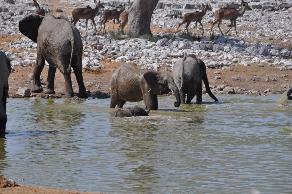
Namibia has no perennial river that both rises and ends within its own borders. Every river that flows year round is a boundary with another country. Everything in the interior is ephemeral, running for a handful of days a year or less. That single fact shapes the country’s wildlife, its settlement pattern and most of its politics with its neighbours.
The Rule That Explains Namibia
It is worth stating plainly because almost nothing else about the country makes sense without it.
Five perennial rivers touch Namibia and all five form international borders. The Kunene, the Okavango, the Kwando and the Zambezi run along the northern edge, shared with Angola, Botswana, Zambia and Zimbabwe. The Orange runs along the southern edge, shared with South Africa.
Between those two extremes, across the entire body of the country, there is no permanent surface water at all. Every interior river is ephemeral: a dry bed for most or all of the year that carries water for a few days after heavy rain and then stops.
That is why Namibian settlement clusters in the north, why Etosha works as a game park by concentrating animals at boreholes, why the desert elephants range hundreds of kilometres, and why water sharing agreements with neighbouring countries carry the political weight they do.
The Northern Perennial Rivers
The four northern rivers are the country’s only reliable water and they support a wholly different Namibia from the one most visitors see.
The Kunene forms the Angolan border in the northwest, rising in Angola and reaching the Atlantic. It produces Epupa Falls and Ruacana Falls, feeds a hydroelectric scheme, and supports crocodiles, palms and a green corridor through the driest country in Namibia.
The Okavango, known in Namibia as the Kavango, comes down from Angola through the Kavango regions and on into Botswana, where it spreads into the delta and never reaches the sea.
The Kwando enters from Angola, runs along the Botswana border, changes name to the Linyanti below Nkasa Rupara and later becomes the Chobe. That single river system carries three names across its length, which confuses map reading in the Zambezi Region.
The Zambezi touches the far northeastern corner. Together these rivers give the Zambezi Region its hippo, crocodile, sitatunga, red lechwe and the best birding in the country.
The Orange River in the South
The Orange forms the entire southern border with South Africa and is the country’s other permanent water.
It rises in the Lesotho highlands and crosses the continent to reach the Atlantic at Oranjemund, where the diamond fields are. Along the Namibian stretch it runs through severe desert, and the contrast between the green ribbon of the riverbank and the barren rock on either side is abrupt.
The Fish River is its major Namibian tributary, joining it in the far south after passing through Fish River Canyon.
Canoeing and rafting trips run on the Orange, usually as multi day expeditions camping on the bank, and it is one of the few places in Namibia where a river is an activity rather than a border to cross.
The border at Noordoewer is the main crossing for travellers driving between Namibia and South Africa.
Never camp in a dry riverbed in Namibia, whatever the shade and soft sand suggest. Ephemeral rivers flood without warning, and the rain that fills them may fall a hundred kilometres upstream in country you cannot see. Riverbeds are also the corridors elephants use at night in the northwest. Camp on the bank above the bed, and treat the sand as a road rather than a bedroom.
The Ephemeral Rivers of the West
The dry rivers running west to the Atlantic are the ones that matter most to a traveller, because they are where the desert wildlife lives.
From north to south they are the Kunene, then the Khumib, Hoarusib, Hoanib, Uniab, Huab and Ugab, then the Omaruru, Swakop, Kuiseb and Tsauchab. Most reach the ocean only in exceptional years and some have not done so in living memory.
Each functions as a linear oasis. Water sits below the sand in the bed, deep rooted trees reach it, and a corridor of ana trees, camel thorn and riverine vegetation runs through country that supports nothing else.
That corridor is what makes the desert adapted elephants possible. They move along these beds between water points, digging in the sand where they know water sits, and around 150 of them survive across five of these systems.
The Kuiseb does something else as well. It runs west along the northern edge of the great dune sea and acts as a barrier, stopping the dunes from migrating further north, which is why the sand ends where it does.
The Tsauchab is the one that ends at Sossusvlei, blocked by dunes from reaching the sea, and in rare years of exceptional rain it fills the pan with water.
The Fish River and the Interior
The Fish River is the longest river entirely inside Namibia, running roughly 650 kilometres south through the interior to join the Orange.
It is ephemeral for most of its length, reduced in the dry season to a chain of pools along the bed. Over an enormous span it cut Fish River Canyon, one of the largest canyons in the world at around 160 kilometres long and 550 metres deep.
The Hardap Dam near Mariental holds it back and is the largest dam in Namibia, creating a body of standing water that is unusual enough here to be a destination in itself.
Elsewhere in the interior, the Nossob and Auob run southeast into the Kalahari and flow roughly once a century. The omuramba of the northeast are ancient dry valleys that hold standing pools during the rains and carry the wildlife of Nyae Nyae and Khaudum.

Why the Rivers Do Not Reach the Sea
Several Namibian rivers simply stop, and the reasons vary in ways worth knowing.
Some are blocked. The Tsauchab is stopped by the dune sea and ends at Sossusvlei. The Okavango, though perennial, spreads into the Kalahari sands of the delta and evaporates.
Most are simply absorbed. Water running down a bed sinks into deep sand and evaporates in heat that can exceed 40 degrees, so a flood starting in the highlands may travel a hundred kilometres and stop.
Others are dammed. The Kunene is heavily managed for hydroelectricity, which is why Ruacana Falls flows properly only when the river is in flood.
What reaches the Atlantic reliably is the Orange in the south and the Kunene in the north, both of them border rivers. The interior gives its water to the sand.
Rivers, People and Politics
Because every permanent river is shared, Namibian water is a diplomatic question rather than only a domestic one.
Angola, Botswana and Namibia have a standing agreement covering the Okavango basin, overseen by a permanent commission, and proposals to draw water from the Okavango during drought have surfaced periodically and been shelved. A future water crisis would revive them.
The Kunene carries a similar history. A long running proposal to dam the river at Epupa, which would have flooded the falls and the valley, was opposed by Himba communities on the grounds that it would submerge ancestral graves and grazing. It was not built.
Meanwhile the interior runs on groundwater. Boreholes support Etosha’s wildlife, farming across the central highlands and much of the country’s settlement, drawing on aquifers that recharge slowly if at all.
Rivers as Places to Visit
The Kunene. Epupa Falls, Ruacana, and remote camps on the Angolan border. Green corridor through the driest country in Namibia. Crocodiles, so no swimming.
The Zambezi Region rivers. Okavango, Kwando, Linyanti and Zambezi. Boat cruises, tiger fishing, hippo, crocodile and the country’s richest birding.
The Orange. Multi day canoe and rafting trips camping on the bank in the far south, and the border crossing at Noordoewer.
The dry western rivers. The Huab, Hoanib and Aba Huab in Damaraland and Kaokoland, where desert adapted elephant range along the beds. Tracked with guides.
Best Time for Namibia’s Rivers
The northern perennial rivers are best from June to October, when floodwaters recede, game concentrates along the banks, roads are passable and malaria risk falls to its annual low.
The ephemeral rivers work differently. They only carry water during and just after the rains from January to March, which is exactly when the roads to reach them become difficult and riverbeds become dangerous.
Seeing an ephemeral river actually running is a matter of luck rather than planning. Travellers who happen to be in Namibia when a dry bed comes down in flood describe it as one of the strangest things they have seen in the country.
Rivers of Namibia Questions
Does Namibia have any permanent rivers?
Yes, five, and every one forms an international border. The Kunene, Okavango, Kwando and Zambezi run along the northern edge, shared with Angola, Botswana, Zambia and Zimbabwe. The Orange forms the entire southern border with South Africa. No perennial river both rises and ends within Namibia’s own borders, which shapes almost everything about the country.
What is an ephemeral river?
A river that is a dry bed for most or all of the year and carries water only for a few days after heavy rain. All of Namibia’s interior rivers are ephemeral. They function as linear oases: water sits below the sand, deep rooted trees reach it, and a corridor of vegetation runs through country that supports nothing else, which is what makes the desert adapted elephants possible.
Why do Namibian rivers not reach the sea?
Different reasons. Some are blocked, like the Tsauchab which the dune sea stops at Sossusvlei. Most are absorbed, with water sinking into deep sand and evaporating in heat above 40 degrees. Others are dammed, like the Kunene for hydroelectricity. Only the Orange in the south and the Kunene in the north reach the Atlantic reliably, and both are border rivers.
Is it safe to camp in a riverbed?
No. Ephemeral rivers flood without warning, and the rain that fills them may fall a hundred kilometres upstream in country you cannot see, so a dry bed under clear sky is not evidence of anything. Riverbeds are also the corridors elephants use at night in the northwest. Camp on the bank above the bed rather than in it.
What is the longest river in Namibia?
The Fish River, running roughly 650 kilometres south through the interior to join the Orange, is the longest river entirely within Namibia. It is ephemeral for most of its length, reduced in the dry season to a chain of pools. Over an enormous span it cut Fish River Canyon, around 160 kilometres long and 550 metres deep.
Can you swim in Namibian rivers?
Not in the northern ones. The Kunene, Okavango, Kwando and Zambezi all hold Nile crocodile and hippo, and both are genuinely dangerous. Local people killed by crocodiles in these regions are not a rarity. The Orange in the south carries no crocodile along most of its Namibian stretch and canoe and rafting trips run on it, though currents deserve respect.
Why does the Kwando have three names?
Because it changes name along its length. It enters from Angola as the Kwando, becomes the Linyanti below the Nkasa Rupara area, and later becomes the Chobe before joining the Zambezi. It is one river system with three names, which makes map reading in the Zambezi Region more confusing than it needs to be.
Booking Your Namibia Trip
The safari companies and tour operators listed on this website put trips like this together for a living and know which camps, guides and routes actually deliver. We are an independent guide to Namibia; we do not book or sell tours ourselves.
When you are ready, arrange your safari, tour or holiday with one of the recognised operators listed here. Tell them your dates and what matters most, and a real person, not a form, will handle the itinerary, park bookings and logistics for you.