Uis and the Brandberg Gateway
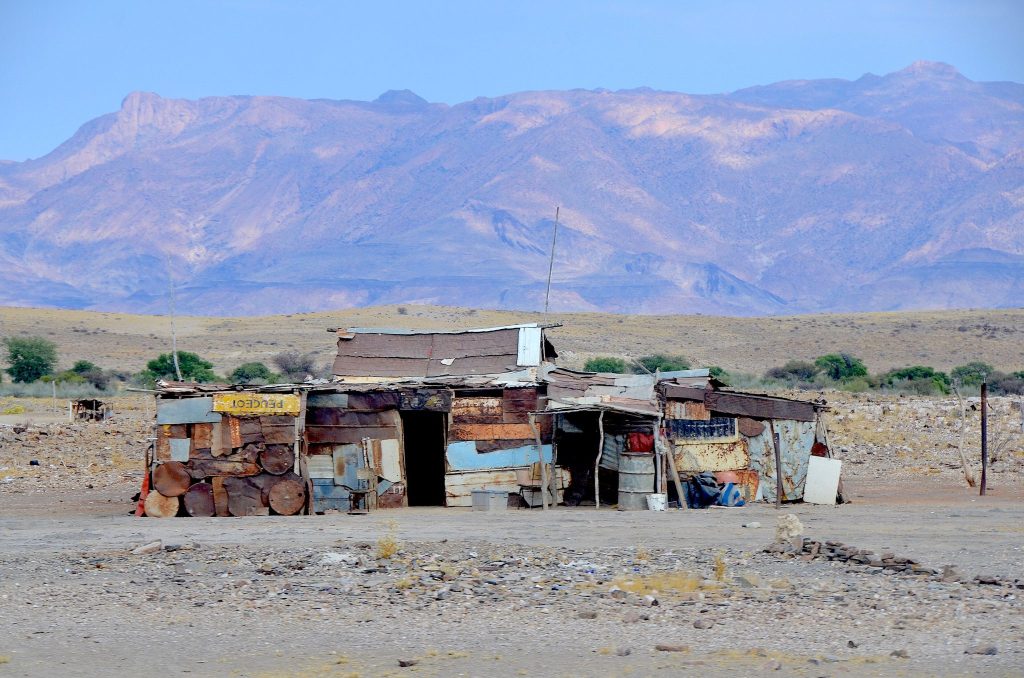
Uis is a former tin mining town of around 3,600 people at the foot of Namibia’s highest mountain. It was downgraded from village to settlement in 2010, which tells you what happened when the mine closed. It survives on passing traffic on the C36 between the coast and Damaraland, and it is the base for climbing Brandberg.
What Uis Is
The town exists because of tin and continues because of a road.
Uis grew around a tin mine, and when mining ceased the settlement lost its economic basis. It was formally downgraded from village to settlement status in 2010, having previously owned around 10 square kilometres of land.
Approximately 3,600 people live there.
Its position on the C36, the main road between the coast and the Damaraland interior, generates a reasonable amount of passing traffic, which is by far the main source of economic activity.
The settlement holds a small supermarket, guesthouses and a rest camp, a bakery and a petrol station, along with a few other small shops.
That is the honest description. Uis is a service point rather than a destination, and it is a useful one.
Fuel and stock up here rather than assuming Damaraland will provide. Uis has the last reliable petrol station before the Brandberg area and the routes north towards Khorixas and Twyfelfontein, and the small supermarket is the last shop of any size. The next dependable options are a long way in every direction, and travellers who treat Uis as a place to drive through find that out later.
Brandberg
The mountain is the reason most travellers come and it dominates everything here.
Brandberg is Namibia’s highest mountain, rising abruptly from the surrounding plain. Uis sits at its foot, which makes the settlement the natural base.
The mountain holds the White Lady rock painting, among the best known rock art images in southern Africa, which some accounts date to over 20,000 years.
The name means fire mountain, from the way the granite glows red in low sun.
Access to the White Lady is on a guided walk into the Tsisab Gorge, around five kilometres return, taking two to three hours over rocky exposed ground. Guides are compulsory.
Summit attempts require a permit and a guide arranged through the National Heritage Council or the rest camp at Uis, and published costs vary widely enough that direct confirmation is necessary.
The White Lady and Its Misreading
The painting’s name is wrong and the story of how it got that way is worth knowing.
The figure was named the White Lady by Abbé Breuil, the French prehistorian, who interpreted it as a Mediterranean or Cretan Greek figure on the basis of its appearance.
That reading has since been discarded. The figure is now widely understood as male and as belonging squarely within the San rock art tradition of the region, most likely depicting a shaman or a figure in ritual context.
Breuil is the same figure who published on Phillip’s Cave in the Erongo, and his interpretations across Namibian rock art carry the same caveat about early European readings.
The name has stuck regardless, which is why signage, guides and every guidebook still use it.
Knowing the correction changes what you are looking at, and honest guides at the site will explain it rather than repeating the original interpretation.
The Tin and What Followed
Mining made the town and its afterlife is visible.
Tin was mined here for decades, and the tailings and workings remain part of the surroundings.
The closure left a settlement without its purpose, which is a pattern repeated at Kolmanskop, Pomona and elsewhere in Namibia, though Uis survived where those were abandoned entirely.
What kept it alive was the road and the mountain.
There has been renewed mining interest in the area in recent years, with lithium and tin both drawing attention, so the settlement’s economic position may change again.
Semi precious stones are sold at roadside stalls in and around Uis, and buyers should ask about provenance and avoid anything collected from protected sites.
The Tin Artisans
One thing Uis produces that nowhere else in Namibia does is worth stopping for.
Local artisans work scrap metal and tin from the mining era into ornaments, animals, vehicles and household objects, sold from roadside stalls and small workshops in the settlement.
The material is a direct legacy of the mine, and the craft grew out of the economic gap its closure left.
Buying here puts money directly into the hands of the makers rather than a lodge gift shop taking a margin, which is the argument for stopping in Uis rather than buying similar pieces elsewhere.
Semi precious stones are also sold at stalls in and around the settlement, drawn from the surrounding geology. Ask about provenance and avoid anything collected from protected sites.
Prices are negotiable and bargaining is expected, though it should stay good humoured given the circumstances of the settlement.
Brandberg Wildlife
The mountain and the surrounding plains hold more than the bare rock suggests.
Desert adapted elephant range through the Ugab River system nearby, one of five ephemeral rivers supporting the roughly 150 genuinely desert dwelling elephants of the northwest.
Hartmann’s mountain zebra work the rocky ground, along with klipspringer on the steeper faces and oryx and springbok on the plains.
Leopard occur on the massif and are almost never seen.
Birding is good for escarpment species, with Herero chat, Benguela long billed lark and rockrunner among the near-endemics found in this country.
Sightings are a matter of luck rather than planning, and travellers coming for wildlife should treat the Ugab riverbed as the place to look.
Where Uis Sits
The position on the C36 is the whole of its practical value.
The road runs between the coast at Henties Bay and Swakopmund and the Damaraland interior towards Khorixas and Twyfelfontein.
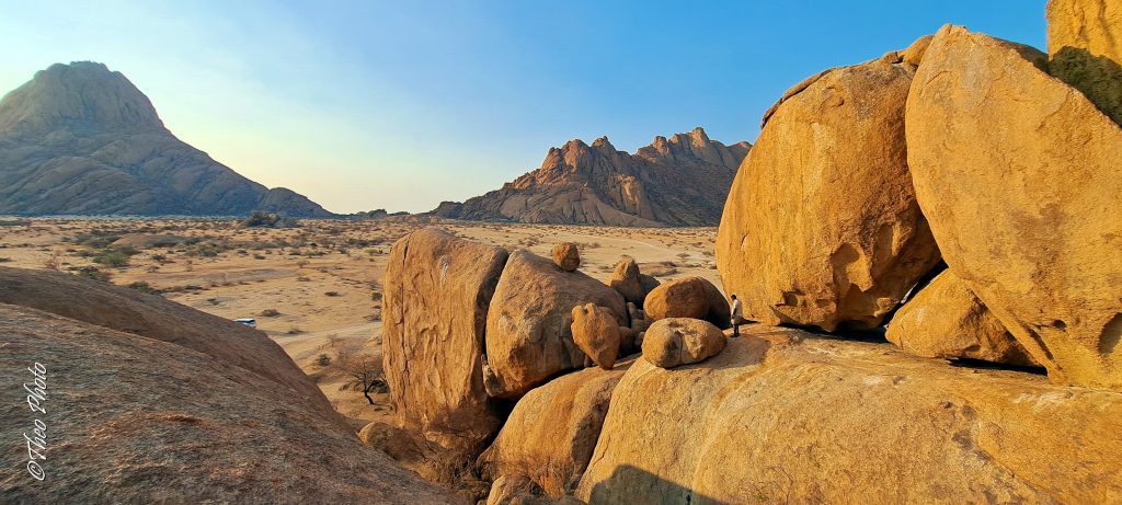
Spitzkoppe lies southeast, with its granite formations, rock arch and community campsite among the best in Africa.
Twyfelfontein, the Organ Pipes, Burnt Mountain and the Petrified Forest sit north towards Khorixas, forming the central Damaraland circuit.
Vingerklip and the Ugab Terraces lie further east.
Travellers driving between Swakopmund and Etosha through Damaraland pass through or close by, which is how most people come across the place.
Where to Stay
Options are limited and adequate.
The Brandberg Rest Camp is the established option, offering rooms and camping, and it is also where summit permits and guides can be arranged.
Several guesthouses operate in the settlement.
Camps and lodges are scattered through the wider Brandberg and Damaraland area for travellers wanting something more comfortable.
Most visitors stay one night, walking to the White Lady in the morning and continuing north or west the same day.
Two nights suits anyone attempting the summit or wanting to combine Brandberg with Spitzkoppe at an unhurried pace.
Spitzkoppe Nearby
The granite cluster southeast of Uis is frequently paired with Brandberg and the two are different propositions.
Spitzkoppe rises abruptly from flat plain as a dramatic isolated cluster, best known for its rock arch and for camping among the boulders. Brandberg is a massif you walk into rather than around.
Both hold San rock art, both need guides for the painting sites, and both work at the ends of the day when granite turns deep orange in low sun.
Spitzkoppe’s community campsite is among the best in Africa and costs almost nothing, with pitches scattered among the boulders, no fences and no electricity.
It is also one of the darkest night sky sites in the country, with the rock arch under the Milky Way a standard composition because it works.
Doing both over two nights, based at Uis for Brandberg and camping at Spitzkoppe, is a natural pairing on the route between the coast and Damaraland.
Practical Notes
Fuel. The last reliable petrol before the Brandberg area and the routes north. Fill here rather than assuming Damaraland will provide.
Walking. The Tsisab Gorge walk is five kilometres return over rocky exposed ground with no shade. Closed shoes, a hat and two litres of water minimum.
Timing. Start the White Lady walk early. Damaraland heat builds fast and the gorge is exposed throughout.
Season. May to September for comfortable walking. Summer temperatures make the gorge walk hard work after mid morning.
Uis and Brandberg Questions
What is Uis?
A former tin mining settlement of around 3,600 people at the foot of Brandberg, Namibia’s highest mountain. It was downgraded from village to settlement status in 2010 after mining ceased, having previously owned around 10 square kilometres of land. It now survives largely on passing traffic on the C36 between the coast and the Damaraland interior.
What is there in Uis?
A small supermarket, guesthouses and a rest camp, a bakery and a petrol station, along with a few other small shops. That is the honest description. Its value to travellers is as a service point: the last reliable fuel and shop before the Brandberg area and the routes north towards Khorixas and Twyfelfontein.
How do I see the White Lady?
On a compulsory guided walk into the Tsisab Gorge, around five kilometres return and taking two to three hours over rocky exposed ground with no shade. Start early, since Damaraland heat builds fast. Bring closed shoes, a hat and at least two litres of water per person. Guides are arranged at the site.
Is the White Lady actually a woman?
Probably not. The figure was named by the French prehistorian Abbé Breuil, who interpreted it as a Mediterranean or Cretan Greek figure. That reading has been discarded, and the figure is now widely understood as male and as belonging within the San rock art tradition, most likely a shaman or ritual figure. The name has stuck regardless and appears on all signage.
Can I climb Brandberg?
Yes, with a permit and a guide arranged through the National Heritage Council or the rest camp at Uis. Published costs vary widely enough that direct confirmation is necessary. It is a serious undertaking on Namibia’s highest mountain rather than a day walk, and it requires a separate arrangement from the White Lady visit.
How long should I stay?
One night suits most travellers, walking to the White Lady in the morning and continuing north or west the same day. Two nights suits anyone attempting the summit or wanting to combine Brandberg with Spitzkoppe at an unhurried pace. The Brandberg Rest Camp offers rooms and camping and is where permits and guides are arranged.
Where does Uis fit on a route?
On the C36 between the coast at Henties Bay and Swakopmund and the Damaraland interior towards Khorixas and Twyfelfontein. Spitzkoppe lies southeast, and Twyfelfontein, the Organ Pipes, Burnt Mountain and the Petrified Forest lie north. Travellers driving between Swakopmund and Etosha through Damaraland pass through or close by.
Booking Your Namibia Trip
The safari companies and tour operators listed on this website put trips like this together for a living and know which camps, guides and routes actually deliver. We are an independent guide to Namibia; we do not book or sell tours ourselves.
When you are ready, arrange your safari, tour or holiday with one of the recognised operators listed here. Tell them your dates and what matters most, and a real person, not a form, will handle the itinerary, park bookings and logistics for you.