Windhoek to Swakopmund Road Trip

The Windhoek to Swakopmund road trip runs about 360 kilometres west on the B2 through Okahandja, Karibib and Usakos, taking roughly four hours on tar the whole way. It is the easiest long drive in Namibia and works in any vehicle. The gravel C28 over the Bosua Pass is shorter in distance and takes almost twice as long.
Windhoek to Swakopmund Route Options
Two roads link the capital to the coast and they suit completely different trips.
The B2 is the main route, tarred from end to end, running northwest out of Windhoek to join the highway near Okahandja and then west through the interior to the Atlantic. It is quick, dull in places and entirely dependable.
The C28 leaves Windhoek directly westward over the Bosua Pass and crosses the Namib to meet the B2 near Swakopmund. At roughly 319 kilometres it is the shortest route on paper and the longest in practice, since it is gravel, steep in sections and takes around seven hours.
The B2. Around 360 kilometres, four to four and a half hours, tarred throughout. Via Okahandja, Karibib, Usakos and Arandis. The route nearly everyone takes.
The C28. Roughly 319 kilometres but about seven hours. Gravel over the Bosua Pass at up to 1,924 metres. Steep descents, low traffic, striking country. Higher clearance advisable.
Via Spitzkoppe. B2 to Usakos then north on the D1918 and D3716. Adds two to three hours and turns the transfer into a proper stop among the granite peaks.
Continuing to Walvis Bay. The B2 runs 30 kilometres further south along the coast. Half an hour of straight tar with the Atlantic on one side and dunes on the other.
The B2 Through Okahandja, Karibib and Usakos
Leave Windhoek north on the B1 for about 70 kilometres to Okahandja, where the B2 branches west. Okahandja has fuel, shops and the largest woodcarving market in Namibia, which is worth twenty minutes on the way out even if you plan to buy on the way back.
From there the B2 runs west through farmland that thins steadily into semi desert. Karibib comes next, a small town known for marble and gemstones, with a couple of shops selling both. Usakos follows, smaller again, with fuel and a farm stall in the area that has a local reputation for biltong and chilli bites.
Beyond Usakos the country opens out completely. Arandis, a uranium mining town, is the last settlement before the coast. The final stretch runs through the eastern edge of the Namib and the change from bush to gravel plain happens over a surprisingly short distance.
The C28 Bosua Pass Route Across the Namib
The C28 is the road for people who want the drive to be the day rather than the gap in it. It climbs west out of Windhoek to nearly 1,900 metres, crosses the escarpment on the Bosua Pass, and drops through Namib-Naukluft National Park to the coastal plain.
The Bosua descent is steep, narrow in sections and unsuitable for anything towing. The surface is gravel throughout and varies considerably with recent weather. Traffic is close to nonexistent, which is much of the appeal and also the reason to tell someone your plan.
Allow seven hours rather than four and treat it as a full day out. It is a genuinely fine road and it is not the one to take when you have a flight to catch or a booked activity at the other end.
Most first day plans on this route fail on arithmetic rather than distance. Between landing, immigration, the airport transfer, a rental handover and a supermarket stop in Windhoek, travellers routinely leave the capital two to three hours later than intended. Count those hours before deciding whether to drive to the coast on arrival day.
Okahandja Craft Market and the First Hour Out of Windhoek
The market at Okahandja is the best of its kind in Namibia and the first hour of this drive is the natural time to use it. Woodcarvings, baskets and stone pieces are sold from dozens of stalls, and prices are negotiable in a friendly rather than pressured way.
Buying on the outbound leg means carrying your purchases for the rest of the trip. Buying on the way back means hoping the piece you liked is still there. Most travellers browse going out and buy coming home.
Gross Barmen, a hot spring resort roughly 25 kilometres southwest of Okahandja, is a common weekend stop for Windhoek residents and works as a short detour if you have time to spare on a long first day.
Spitzkoppe as a Detour on the Swakopmund Drive
Spitzkoppe sits north of the B2 beyond Usakos and adds two to three hours to the drive, which is why most people do it as a separate overnight rather than a stop. A cluster of granite peaks rising from flat gravel, with rock art, short scrambles and a rock arch, it is one of the more photogenic places in the country.
The community rest camp there has widely scattered pitches, minimal facilities and some of the darkest skies in Namibia. As a stop on a Windhoek to coast leg it is rushed. As a night between the coast and Damaraland it is excellent.
If you only have the day, look at it from the road. The peaks are visible from the B2 area and the shape of them is most of the impression.
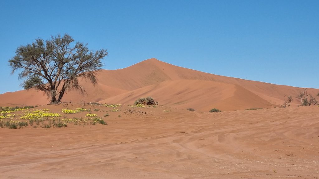
Arriving on the Coast and the Moon Valley Detour
The last hour into Swakopmund crosses gravel plains where the fog belt starts, and the temperature drop is abrupt. Travellers arriving from the interior in shorts regularly reach the coast reaching for a jacket.
Moon Valley and the welwitschia plains lie inland of Swakopmund in the Namib section of Namib-Naukluft National Park, reached on a loop from the coast rather than from the B2. Both need a permit obtained from Ministry offices beforehand rather than at a gate, which catches people out since there is no barrier to pay at.
Most travellers do that circuit as a half day trip from Swakopmund the following day rather than trying to fold it into the arrival drive.
Continuing to Walvis Bay on the Coastal B2
The B2 does not end at Swakopmund. It runs another 30 kilometres south along the coast to Walvis Bay, half an hour of straight tar with the Atlantic on one side and the start of the dune belt on the other.
Pull offs at Long Beach and Vogelstrand have benches and good angles for photographs. Dune 7, often described as the tallest dune in the area, sits beside this road and takes well under an hour to climb.
Travellers flying into Walvis Bay airport rather than Windhoek reverse this leg, and it makes a considerably shorter first drive for anyone starting a trip on the coast.
Fuel, Timing and Road Conditions
The B2 is tarred and in good condition throughout, with fuel at Okahandja, Karibib, Usakos, Arandis and both coastal towns. This is the one Namibian route where fuel planning is not a concern.
Timing is the real constraint. Four hours is comfortable but not if you start late, and driving after dark on any Namibian road brings the risk of livestock and kudu on unfenced sections. Aim to leave Windhoek by early afternoon at the latest.
If you cannot manage that, Okahandja is the practical place to break the drive, since Karibib and Usakos have limited accommodation. Many travellers arriving on an afternoon flight sleep in Windhoek and drive to the coast fresh the next morning, which is the simpler answer.
Best Time for the Windhoek to Swakopmund Drive
The B2 works year round since it is tarred, so season affects the destination more than the drive. The coast stays cool and often fogbound whatever the interior is doing, which makes this a good run in the hottest months when Windhoek and the desert are above 40 degrees.
December and January bring Namibian and South African holidaymakers to the coast in numbers, so book accommodation ahead for those weeks. The C28 gravel alternative is best avoided after heavy summer rain, when the pass sections deteriorate.
Vehicle Choice and Entry Requirements
Any vehicle handles the B2, including a small saloon, in any season. The C28 wants higher clearance and is not suitable for towing. A 4×4 matters for the wider trip rather than for this leg.
Vehicles are collected at Hosea Kutako International Airport, 40 kilometres east of Windhoek, or at city depots. Walvis Bay airport is the alternative arrival point for trips starting on the coast and removes this drive entirely.
Entry rules changed recently and much published advice has not caught up. Namibia withdrew visa free entry for many European, North American and Australasian passports, so travellers from those countries now need a visa on arrival or a holiday visa arranged online beforehand, along with six months of passport validity and three blank pages.
Windhoek to Swakopmund Drive Questions
How long does the Windhoek to Swakopmund drive take?
About four to four and a half hours for roughly 360 kilometres on the B2, excluding stops, and closer to five with fuel and a market break at Okahandja. Continuing to Walvis Bay adds another half hour. The gravel C28 over the Bosua Pass is shorter in distance at around 319 kilometres but takes about seven hours, so it is a day out rather than a transfer.
What does the drive cost?
Fuel one way typically runs somewhere around 450 to 700 Namibian dollars depending on the vehicle and current pump prices, with no tolls on the route. Bus services between the two cities exist and cost roughly 45 to 55 US dollars, though they take considerably longer than driving and leave you without a vehicle at the coast.
Which route should I take to Swakopmund?
The B2 for almost everyone. It is tarred end to end, well maintained, has fuel throughout and takes four hours. Consider the C28 over the Bosua Pass only if the drive itself is the plan, you have a full day, and you are in something with reasonable ground clearance. Adding Spitzkoppe via Usakos is the better way to make the day interesting without committing to seven hours of gravel.
Can I drive to Swakopmund on my arrival day?
Possible on a morning flight, tight on an afternoon one. Immigration, the transfer from the airport, the rental handover and a supermarket stop routinely add two to three hours before you leave Windhoek. If you land after midday, sleeping in Windhoek or Okahandja and driving fresh the next morning is the safer plan, since arriving at the coast after dark means driving unfenced roads at the worst time.
Do I need a 4×4 for this drive?
No. The B2 is tarred the whole way and any vehicle including a small saloon manages it comfortably. Higher clearance is worth having for the C28 alternative and for the wider Namibian trip, particularly if it includes the sandy section at Sossusvlei or Damaraland tracks, but this leg does not require it.
What is there to stop for between Windhoek and Swakopmund?
Okahandja for the woodcarving market about an hour out, which is the best of its kind in the country. Karibib for marble and gemstones. Usakos for fuel and a well regarded farm stall in the area. Spitzkoppe is the one substantial detour, adding two to three hours via Usakos, though it works better as an overnight than a stop.
Is there public transport from Windhoek to Swakopmund?
Yes, buses run between the two cities and cost roughly 45 to 55 US dollars, though travel times are far longer than driving once transfers are counted. The larger problem is that Swakopmund is a base for activities spread across the coast, including Walvis Bay and Sandwich Harbour, and without a vehicle you are dependent on tours for all of them.
Booking Your Namibia Trip
The safari companies and tour operators listed on this website put trips like this together for a living and know which camps, guides and routes actually deliver. We are an independent guide to Namibia; we do not book or sell tours ourselves.
When you are ready, arrange your safari, tour or holiday with one of the recognised operators listed here. Tell them your dates and what matters most, and a real person, not a form, will handle the itinerary, park bookings and logistics for you.