Grootfontein
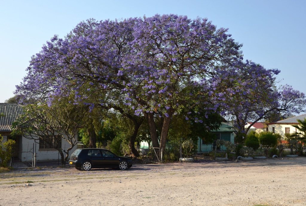
Grootfontein is the gateway to Namibia’s northeast, the last substantial town before the long run east to Rundu and the Zambezi Region or northeast into Bushmanland and Khaudum. The Hoba Meteorite, the largest intact meteorite on earth, sits about 20 kilometres west. The town takes its name from a large spring.
Where the Roads Run Out
Grootfontein’s role is best understood by looking at what lies beyond it.
The town sits at the eastern corner of the Otavi Triangle in the Otjozondjupa Region, and from here the country changes. East on the B8 runs 250 kilometres to Rundu and then along the Caprivi Strip to Katima Mulilo, well over a thousand kilometres from Windhoek in total.
Northeast on the C44 runs to Tsumkwe, the Nyae Nyae Conservancy and the southern entrance to Khaudum National Park, into deep Kalahari sand where two vehicles in convoy become a requirement rather than advice.
That makes Grootfontein the last place with comprehensive services before some of the emptiest country in Namibia, and it is why the town matters more than its size suggests.
Around 25,000 people live here in a settled agricultural town with wide streets and considerable greenery.
The Spring and the Name
Grootfontein means large spring in Afrikaans, and the water is why anything is here.
The Herero name for the area was Otjivanda, and the site mattered long before European settlement. A permanent spring in this part of Africa determines where people live.
The town sits within the Otavi Triangle alongside Tsumeb and Otavi, a corner of Namibia receiving over 550 millimetres of rain a year. That is exceptionally high by national standards and several times what the interior gets, which is why this pocket supports intensive agriculture while the country around it does not.
Maize, grain, fruit and vegetables are grown here, and the country is green and farmed in a way that surprises visitors arriving from the desert.
The combination of reliable water above and ore below is what put three towns in this small triangle.
The Hoba Meteorite
The largest intact meteorite ever found on earth sits about 20 kilometres west of town and is covered in full on its own page.
Briefly: it weighs somewhere around 60 tonnes, is roughly 82 percent iron and 16 percent nickel, arrived around 80,000 years ago and has never been moved because nobody has worked out how.
It was found in 1920 by a farmer working land on the farm Hoba West, and it was declared a national monument in 1955 after souvenir hunters began taking pieces.
You can walk up to it, touch it and stand on it, which is unusual for a world class natural object anywhere.
A stone amphitheatre was built around it, sunk into the ground so visitors descend to it, alongside a visitors’ centre and a walkway planted with labelled indigenous trees.
It takes half an hour to forty five minutes and sits on the road between Grootfontein and the north, which makes it close to unmissable.
Fill up completely at Grootfontein before heading east or northeast, and buy more supplies than you think. The next comprehensive town going east is Rundu, 250 kilometres away, and going northeast there is nothing at all until Tsumkwe, which has limited stock. Travellers who treat Grootfontein as a passing town rather than a resupply point regret it.
The Mines and the Fossils
The area northeast of Grootfontein has a mining history worth knowing.
The Berg Aukas and Abenab mines were substantial producers of zinc and vanadium, driving much of the town’s growth, and though they have ceased operations their legacy remains in the dolomite terrain.
That dolomite has yielded fossils and minerals that give insight into prehistoric life in the region, and the karst geology that produced the ore also produced the caves and sinkholes characteristic of the area.
The same karst system created Lake Otjikoto and Lake Guinas near Tsumeb, both formed by collapsed cave ceilings, and Namibia’s only two natural lakes.
The Dragon’s Breath Cave near Grootfontein contains the largest known underground lake in the world, discovered in the eighties. It is not open to casual visitors and requires serious caving expertise, but it is a genuinely odd thing to have on the doorstep.
The Old Fort and Town History
Grootfontein’s German colonial period left a fort that now houses the town museum.
The building dates from the German administration and served as a Schutztruppe post, reflecting the town’s position at the edge of colonial control with the Kalahari and Bushmanland beyond.
The museum covers local history, the mining period, colonial material and the peoples of the region, and it is small and worth an hour if you are staying the night.
Colonial era buildings survive along the older streets, in the same style found in Tsumeb, Otavi and Otjiwarongo.
The town also has a South African military history, having hosted a substantial base during the years of South African rule and the liberation war, which drove its development through the later twentieth century.
Gateway to Bushmanland
The route northeast from Grootfontein leads into country unlike anywhere else in Namibia.
Tsumkwe, around 300 kilometres east on the C44, is the administrative centre of the Nyae Nyae area and the only place to buy anything across an enormous region.
Nyae Nyae Conservancy surrounds it, covering around 8,992 square kilometres and home to the Ju/’hoansi San, who have lived here for thousands of years and now hold formal rights over the land’s wildlife and tourism. It was the first communal conservancy registered in Namibia.
Khaudum National Park lies north of that, roughly 4,000 square kilometres of deep Kalahari sand requiring two 4x4s in convoy, three days of food per person and 100 litres of water per vehicle.
Both are covered separately and neither is a casual excursion. Grootfontein is where the preparation for them happens.
The San Communities Around Grootfontein
Grootfontein sits at the edge of a region with a difficult and important history.
The country northeast of here, historically called Bushmanland, is the homeland of San communities including the Ju/’hoansi, who have lived in this area for thousands of years and are among the oldest continuously resident populations in Africa.
Their circumstances remain hard. Literacy in the Nyae Nyae area runs at around 20 percent and school attendance at roughly half the national average, with very few formal employment opportunities and negligible representation in government. The Ju/’hoansi are one of only two of the six San traditional authorities in Namibia to hold official recognition.
Some San communities were displaced during the South African military period, when men were recruited as trackers and settled near bases, and the aftermath of that still marks several settlements in this region.
The Nyae Nyae Conservancy, registered in 1998 as the first communal conservancy in Namibia, returned formal rights over wildlife and tourism to the Ju/’hoansi on their own land, and it remains the substantial San managed area in the country.
Visitors heading northeast should book cultural activities through the conservancy or through lodges operating as partnerships with it, rather than through operators based elsewhere.
Practical Services
For self drivers this is the substance of Grootfontein’s usefulness.
Supermarkets are properly stocked and this is the last chance for a comprehensive shop before Rundu going east or before nothing at all going northeast.
Fuel, banks, ATMs, a hospital, pharmacies and vehicle workshops are all present. If something on the car needs attention before a long stretch of gravel and sand, this is the place.
Accommodation runs to hotels, guesthouses and lodges in and around town, along with campsites, and it is inexpensive by Namibian standards.
Mobile coverage is good here and deteriorates sharply in both onward directions.
Travellers heading for the Zambezi Region should note that malaria risk rises considerably east of here and take advice accordingly.
Best Time to Visit
The town works year round, and the timing question is really about where you are going next.
For the Zambezi Region and Khaudum, the dry season from June to October is the practical window, when tracks are passable, floodwaters have receded and malaria risk is at its annual low.
The rains from November to April make the northeast difficult, flooding roads in the Zambezi and turning Khaudum’s sand tracks to mud, while greening the farmland around Grootfontein considerably.
Winter nights are cold here, dropping to single figures, and the Kalahari beyond gets colder still.
Getting to Grootfontein
Grootfontein sits on the B8 about 60 kilometres southeast of Tsumeb and roughly 460 kilometres north of Windhoek via Otjiwarongo and Otavi.
The B8 runs east to Rundu, 250 kilometres away, and on along the Caprivi Strip. The C44 runs northeast to Tsumkwe and the Nyae Nyae area.
Etosha’s eastern Von Lindequist Gate is reachable via Tsumeb, roughly 160 kilometres northwest in total.
The B8 and B1 are tarred. The C44 to Tsumkwe is gravel and sand and deteriorates as you go, and everything beyond Tsumkwe requires four wheel drive.
Grootfontein Questions
Why stop in Grootfontein?
Because of what lies beyond it. It is the last town with comprehensive services before the 250 kilometre run east to Rundu and the Caprivi Strip, or northeast into Bushmanland, Nyae Nyae and Khaudum where there is nothing at all until Tsumkwe. Fuel completely, shop properly and get any vehicle attention seen to here.
What does Grootfontein mean?
Large spring, in Afrikaans, and the water is why the town exists. The Herero name for the area was Otjivanda and the site mattered long before European settlement. A permanent spring in this part of Africa determines where people live, and the surrounding Otavi Triangle receives over 550 millimetres of rain a year, exceptionally high by Namibian standards.
How far is the Hoba Meteorite?
About 20 kilometres west of town on a short signposted gravel road, manageable in any vehicle. It is the largest intact meteorite on earth at around 60 tonnes, roughly 82 percent iron, and you can walk up to it, touch it and stand on it. The visit takes half an hour to forty five minutes including the visitors’ centre and the planted walkway.
What is Dragon’s Breath Cave?
A cave near Grootfontein containing the largest known underground lake in the world, discovered in the nineteen eighties. It is not open to casual visitors and reaching the lake requires serious caving expertise. It is a product of the same karst geology that created Lake Otjikoto and Lake Guinas near Tsumeb, Namibia’s only two natural lakes, both formed by collapsed cave ceilings.
Can I reach Bushmanland from Grootfontein?
Yes, on the C44 northeast to Tsumkwe, around 300 kilometres, which is the administrative centre of the Nyae Nyae area and the only place to buy anything across an enormous region. Nyae Nyae Conservancy surrounds it, home to the Ju/’hoansi San and the first communal conservancy registered in Namibia. Khaudum National Park lies north of that and requires two vehicles in convoy.
Is there anything to see in the town itself?
The old German fort houses the town museum, covering local history, the mining period and the peoples of the region, and it is worth an hour if you are staying the night. Colonial era buildings survive along the older streets. Beyond that Grootfontein is a working agricultural town rather than a sightseeing destination, and its value to travellers is practical.
What was mined here?
Zinc and vanadium at the Berg Aukas and Abenab mines northeast of town, which were substantial producers and contributed considerably to the town’s growth. Operations have ceased, but the dolomite terrain has yielded fossils and minerals giving insight into prehistoric life in the region. The same karst geology produced the caves and sinkholes characteristic of the area.
Booking Your Namibia Trip
The safari companies and tour operators listed on this website put trips like this together for a living and know which camps, guides and routes actually deliver. We are an independent guide to Namibia; we do not book or sell tours ourselves.
When you are ready, arrange your safari, tour or holiday with one of the recognised operators listed here. Tell them your dates and what matters most, and a real person, not a form, will handle the itinerary, park bookings and logistics for you.