Dorob National Park
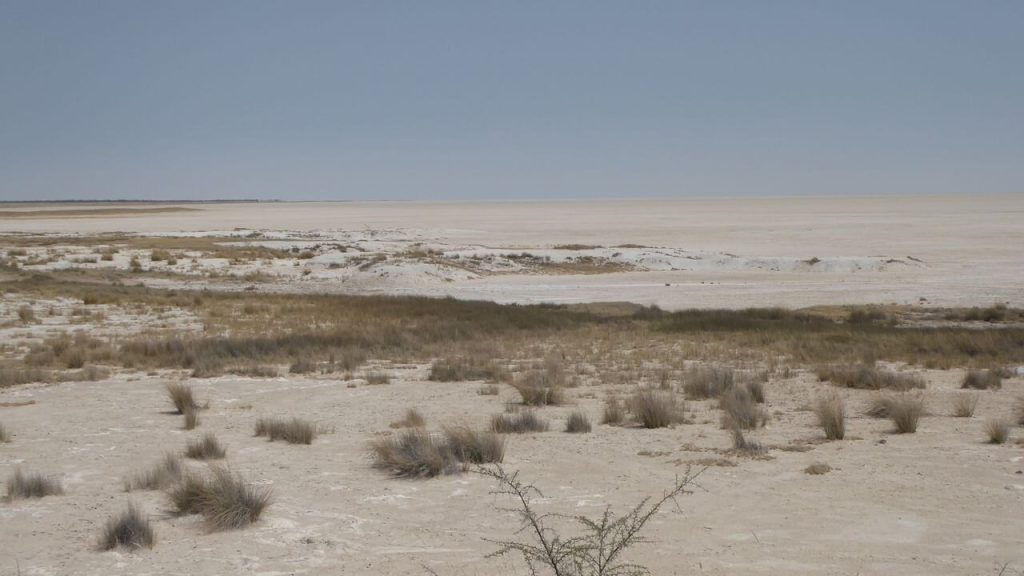
Dorob is the national park most visitors drive through without knowing it exists. It runs along the coast from the Kuiseb River to the Ugab, taking in Swakopmund, Henties Bay, Cape Cross and the salt road, and it needs no permit. Its restrictions on off road driving exist to protect lichen fields and a breeding tern, and they are enforced.
What Dorob Actually Is
The park was proclaimed relatively recently and it filled a gap in the coastal protection network.
Dorob runs along the Namibian coast between the Kuiseb River in the south and the Ugab River in the north, which places it between Namib-Naukluft below and Skeleton Coast National Park above.
Together those three form a continuous protected coastal strip running close to the length of the country, part of the Namib Skeleton Coast National Park complex.
The name comes from a Damara or Nama word for dry land.
What makes it unusual among national parks is that it contains towns. Swakopmund, Walvis Bay and Henties Bay sit within or adjacent to it, along with a tarred and salt road network, holiday cottages, fishing spots and an active recreational economy.
That is why it needs no entry permit for the main routes and why most visitors never realise they are inside a national park at all.
Do not drive off the marked tracks anywhere on the gravel plains, whatever the ground looks like and whatever the photograph would be worth. The grey and orange crusts on the ground are lichen, living organisms surviving entirely on coastal fog, and a single set of tyre tracks through them stays visible for decades. That is the direct reason the restrictions exist, and it is the one rule in Dorob that matters most.
Cape Cross
The park’s best known site sits north of Henties Bay and it is worth clearing up a common confusion.
Cape Cross is inside Dorob National Park, not inside Skeleton Coast National Park, which sits north of the Ugab gate. That means no Skeleton Coast permit is required to reach it, which surprises travellers who assume otherwise.
It holds one of the largest Cape fur seal breeding colonies in the world, viewed from boardwalks, with numbers running well into six figures at the seasonal peak.
The Portuguese navigator Diogo Cão landed here in 1486 and erected a stone cross, which gives the place its name. Replicas stand at the site.
Black backed jackal work the colony fringes taking pups, and brown hyena occur along this coast feeding almost entirely on seals, which is ecologically unique for the species.
Angling is prohibited entirely inside the Cape Cross Seal Reserve, which surprises anglers used to fishing freely along this shore.
The Lichen Fields
The most important thing in Dorob is the thing that looks like coloured gravel.
Lichens are composites of a fungus with an alga or cyanobacterium rather than plants, and more than a hundred species occur in the Namib, forming among the more extensive lichen fields anywhere on earth.
They survive entirely on coastal fog, which is the only dependable moisture on this coast, and they grow extremely slowly.
Pour a little water on a dry patch and it changes colour and unfurls within minutes, which guides demonstrate on desert tours and which is startling the first time.
The fields north of Wlotzkasbaken and around Cape Cross on the C34 salt road are the accessible ones.
A single set of vehicle tracks through a lichen field remains visible for decades, which is why off road driving is restricted across the whole park and why the rule is enforced rather than advisory.
The Damara Tern
The other reason for the driving restrictions is a bird most visitors have never heard of.
The Damara tern is endangered and near-endemic to Namibia, with the great majority of its world population breeding on this coast.
It nests on open coastal gravel flats, laying directly on the ground in shallow scrapes, which is exactly the terrain that off road vehicles cross.
Nests are close to invisible and a vehicle driving over a breeding area destroys eggs and chicks without the driver ever knowing.
That is the second direct reason for vehicle restrictions across Dorob, and several areas are closed seasonally during breeding.
Respecting the closures is the single most useful thing a visitor can do for a species that has very few other places to go.
What Else Is in the Park
Dorob covers a good deal of what visitors do on the Namibian coast.
The Zeila shipwreck sits about 14 kilometres south of Henties Bay off the C34, close inshore, reachable on a short walk from a parking area with no permit needed. It is the most accessible wreck on the coast.
The salt road, the C34 running north from Swakopmund, is a distinctive surface made from salt and gypsum that sets hard and drives like tar when maintained.
Henties Bay is the shore angling capital, with a caravan park, holiday houses and competitions over the December holidays.
Wlotzkasbaken is a scatter of holiday cottages on the open coast, each with its own water tank, which is one of the odder settlements in Namibia.
The Messum Crater, an eroded volcanic caldera inland from Cape Cross, is a remote 4×4 destination requiring care and preferably a guide.
The Salt Road
The C34 running north from Swakopmund is one of the odder pieces of infrastructure in Namibia and it deserves an explanation.
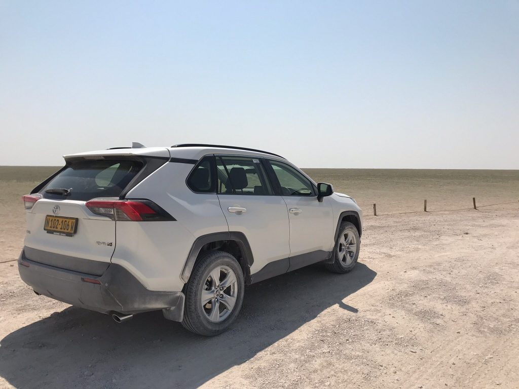
It is built from salt and gypsum rather than tar, compacted and left to set. Fog and the salt content keep the surface damp, which binds it hard enough to drive like tar when it is properly maintained.
The result is a road that looks pale grey, feels smooth and is considerably better than the gravel most of the country runs on. It is also cheap to build in a place with no rock and abundant salt.
The catch is rain. Salt roads soften when genuinely wet, which is rare on this coast, and they become slippery. Grading happens regularly and the surface varies.
Do not treat it as tar. Speeds should stay lower than the surface invites, and the same rules about slowing for oncoming vehicles apply, since stones thrown up still crack windscreens.
The road runs from Swakopmund past Wlotzkasbaken and Henties Bay to Cape Cross and on to the Ugab gate, which is the full length of Dorob’s coastline.
Wildlife
The park supports considerably more than the bare gravel suggests.
Cape fur seals in enormous numbers at Cape Cross, along with the brown hyena and black backed jackal that depend on them.
The Damara tern breeds here, along with other coastal and wetland birds, and the Walvis Bay and Sandwich Harbour wetlands to the south hold flamingos, pelicans, cormorants and waders in tens of thousands.
Oryx, springbok and ostrich work the gravel plains inland, appearing in country that looks incapable of supporting anything.
The small Namib specialists occur throughout: Namaqua chameleon, palmato gecko, sidewinding adder, dancing white lady spider and fog basking beetles, none of which are visible without a guide reading tracks.
Welwitschia and lichen make up the botanical interest, both of them running on fog.
Visiting Dorob
No permit needed. The main routes through Dorob, including the C34 salt road, Swakopmund, Henties Bay and Cape Cross, require no park permit, unlike Skeleton Coast north of the Ugab gate.
Stay on tracks. Off road driving is restricted throughout, for the lichen fields and the Damara tern breeding grounds. This is enforced rather than advisory.
Fishing permits. Angling requires a permit from Ministry offices in Swakopmund, Walvis Bay or the police station at Henties Bay, and is prohibited inside the Cape Cross reserve.
Quad biking. Restricted to designated areas of the dune belt near Swakopmund, for the same ground protection reasons.
Best Time to Visit
The coast runs its own weather and stays mild year round, between roughly 15 and 25 degrees, which makes Dorob workable in every month.
That also makes it the refuge when the interior is above 40 degrees, which is why Namibian families holiday here in December and January.
Fog is the daily variable. Mornings are frequently fogbound and usually clear by late morning, and wind builds through the afternoon reliably.
Morning is the operative window for anything weather dependent, including boat trips, scenic flights and photography.
The seal breeding peak in November and December brings the highest numbers at Cape Cross, along with pups and the predators working the colony.
Damara tern breeding closures apply seasonally, so check current restrictions locally.
Dorob National Park Questions
Do I need a permit for Dorob National Park?
Not for the main routes, which is unusual for a Namibian national park. The C34 salt road, Swakopmund, Henties Bay, Cape Cross and the Zeila shipwreck all require no park permit. That changes north of the Ugab gate, where Skeleton Coast National Park begins and a permit is required, with self drive going no further than Terrace Bay.
Is Cape Cross in the Skeleton Coast park?
No, and this is a common confusion. Cape Cross sits inside Dorob National Park, south of the Ugab gate, so no Skeleton Coast permit is needed to reach it. It holds one of the largest Cape fur seal breeding colonies in the world, viewed from boardwalks, and the site where Diogo Cão erected a stone cross in 1486.
Why can I not drive off the tracks?
Two reasons. The grey and orange crusts on the gravel plains are lichen, living organisms surviving entirely on coastal fog, and a single set of tyre tracks stays visible for decades. And the endangered Damara tern nests directly on open coastal gravel in scrapes that are close to invisible, so a vehicle destroys eggs and chicks without the driver knowing.
What is the Damara tern?
An endangered seabird near-endemic to Namibia, with the great majority of its world population breeding on this coast. It nests on open coastal gravel flats in shallow scrapes laid directly on the ground, which is exactly the terrain off road vehicles cross. Several areas are closed seasonally during breeding, and respecting those closures matters for a species with few alternatives.
What can I see in Dorob?
Cape Cross with its seal colony, the Zeila shipwreck 14 kilometres south of Henties Bay, the salt road, the lichen fields north of Wlotzkasbaken, and the Messum Crater inland for those with 4×4 capability. Wildlife includes seals, brown hyena, black backed jackal, oryx, springbok, ostrich and the small Namib specialists found on guided desert tours.
Where does Dorob begin and end?
Between the Kuiseb River in the south and the Ugab River in the north, sitting between Namib-Naukluft below and Skeleton Coast National Park above. Together the three form a continuous protected coastal strip running close to the length of the country. Unusually for a national park, Dorob contains towns including Swakopmund, Walvis Bay and Henties Bay.
Can I fish in Dorob?
Yes, with a permit from Ministry of Fisheries offices in Swakopmund, Walvis Bay or Lüderitz, or from the police station at Henties Bay. Angling is permitted from the Ugab River to Walvis Bay within the park. It is prohibited entirely inside the Cape Cross Seal Reserve. Bait rules apply: worms may not be used and only washed up red bait may be collected.
Booking Your Namibia Trip
The safari companies and tour operators listed on this website put trips like this together for a living and know which camps, guides and routes actually deliver. We are an independent guide to Namibia; we do not book or sell tours ourselves.
When you are ready, arrange your safari, tour or holiday with one of the recognised operators listed here. Tell them your dates and what matters most, and a real person, not a form, will handle the itinerary, park bookings and logistics for you.