The Sperrgebiet and Tsau Khaeb National Park
Closing a place to people for a century turns out to be an effective conservation method. The Sperrgebiet was sealed off in 1908 to protect diamonds and inadvertently protected one of the world’s great biodiversity hotspots. It holds around 1,050 plant species, roughly a quarter of Namibia’s entire flora, on less than three percent of the country’s land.
The Forbidden Territory
The name is German for prohibited area and it was enforced absolutely.
A railway worker named Zacharias Lewala spotted the first diamond near Grasplatz station in April 1908, and reported it to his supervisor August Stauch. The find triggered a diamond rush across German South West Africa.
In September 1908 the German colonial government created the Sperrgebiet, granting sole mining rights to the Deutsche Diamantengesellschaft.
Penalties for approaching within a hundred kilometres were severe, which is what gave the area its reputation and its name.
The restriction held for close to a century, through German rule, South African administration and into independence, with De Beers controlling the area for much of that period.
Members of the public are still banned from most of it, and the Namibian name Tsau ǁKhaeb translates roughly as soft sand or deep sandy soils.
Book several days ahead if you want to go in. Registered operators run day trips into Tsau Khaeb, and the permits take time to obtain, so this cannot be arranged on arrival in Lüderitz the way a Kolmanskop ticket can. Kolmanskop and Agate Beach are the exceptions that need no special permit. Everything else, including Bogenfels and Pomona, requires an operator and paperwork.
An Accidental Nature Reserve
The conservation outcome was unintended and it is the most interesting thing about the place.
Closing the area to protect mineral wealth also excluded farming, grazing, settlement, roads and tourism for a century, which left the ecosystem largely undisturbed.
The park protects part of the Succulent Karoo biome, which extends into South Africa and is classified among the world’s top biodiversity hotspots. It has the greatest diversity of succulent flora anywhere on earth.
Around 1,050 plant species occur in the park, close to 25 percent of Namibia’s entire flora, on less than three percent of the country’s land area.
Many of those plants survive entirely on fog rolling in off the Atlantic rather than on rain, in the same way the lichen fields and welwitschia further north do.
The park also holds giant rock arches, meteor craters, fossil beds and archaeological sites, including the most important shipwreck discovery in Africa.
It is described as the most biodiverse region in Namibia, which is not what most visitors would guess from a country whose flagship parks are savanna and dune.
The Proclamation and Its Dates
Sources give different dates for the park’s creation and the discrepancy is worth flagging rather than papering over.
Some sources give 2004 as the date of establishment. Others, including Namibian tourism publications, give 2008 as the year of proclamation and renaming.
The likely explanation is that the two dates mark different stages of a long process, with establishment and formal proclamation separated by several years, and with the transfer of control from mining interests to the environment ministry taking longer again.
De Beers retained control pending completion of a management plan, with the intention that authority would pass to the Ministry of Environment.
The area covers around 26,000 square kilometres, roughly three percent of Namibia. One published figure of 22 square kilometres is an obvious error and appears in more than one place.
The practical position for a visitor is unchanged by any of this: most of the park remains closed and access requires an operator and a permit.
What You Can Actually See
A short list of sites is open with the right arrangements.
Bogenfels is the headline: a natural rock arch rising directly from the sea, around 55 metres high, reached on a long 4×4 day from Lüderitz with a permit and an operator.
Pomona is an abandoned diamond mining town, and it experiences the highest wind velocities recorded in Namibia, which visitors feel immediately.
Saddle Hill has spectacular dunes and is among the accessible sites.
Elizabeth Bay is another abandoned mining settlement, closer to Lüderitz.
Kolmanskop, the best known ghost town, sits at the edge of the restricted area and needs only a standard permit bought the day before in Lüderitz. Agate Beach likewise needs no special permit.
Birding draws a number of visitors, and the park is popular with experienced 4×4 travellers.
The Diamonds
The mining history explains both the restriction and the geography of the deposits.
Diamonds here were not mined from pipes in the ground but gathered from surface deposits, carried down the Orange River from the interior over an enormous span and distributed north along the coast by currents and wind.
In the early days they were plentiful enough that accounts describe them glittering in valleys by moonlight, picked up by hand rather than dug for.
Around five million carats were recovered before production was interrupted by the First World War.
Larger stones were later found near Oranjemund at the river mouth, and the industry gradually moved south, which is why Kolmanskop and Pomona were abandoned.
Water was the constraint on everything. At the start of the twentieth century there was almost none, and it was obtained through salt condensers at Lüderitz or shipped from the Cape Colony.
The Bom Jesus
The archaeological discovery in the park is a major one and few visitors have heard of it.
The Bom Jesus, a Portuguese vessel that sank in the early fifteen hundreds, was found near Oranjemund inside the diamond area, exposed during mining operations.
It is the oldest shipwreck found in sub-Saharan Africa and among the most important archaeological finds on the continent.
The recovery took close to two years and involved international archaeologists working inside the restricted zone.
The cargo included copper ingots, ivory and a substantial quantity of gold coins, which is what allowed the ship and its period to be identified with confidence.
The find is a direct consequence of the mining that closed the area, since nothing else would have moved that quantity of sand.
Wildlife and the Coast
The park’s animal life gets less attention than its plants and is worth knowing about.
Brown hyena work this coastline, feeding largely on Cape fur seal pups in the same way they do further north, and the southern Namib population has been studied for three decades from a project based at Lüderitz.
Cape fur seal colonies occur along the shore, along with the black backed jackal that work their fringes.
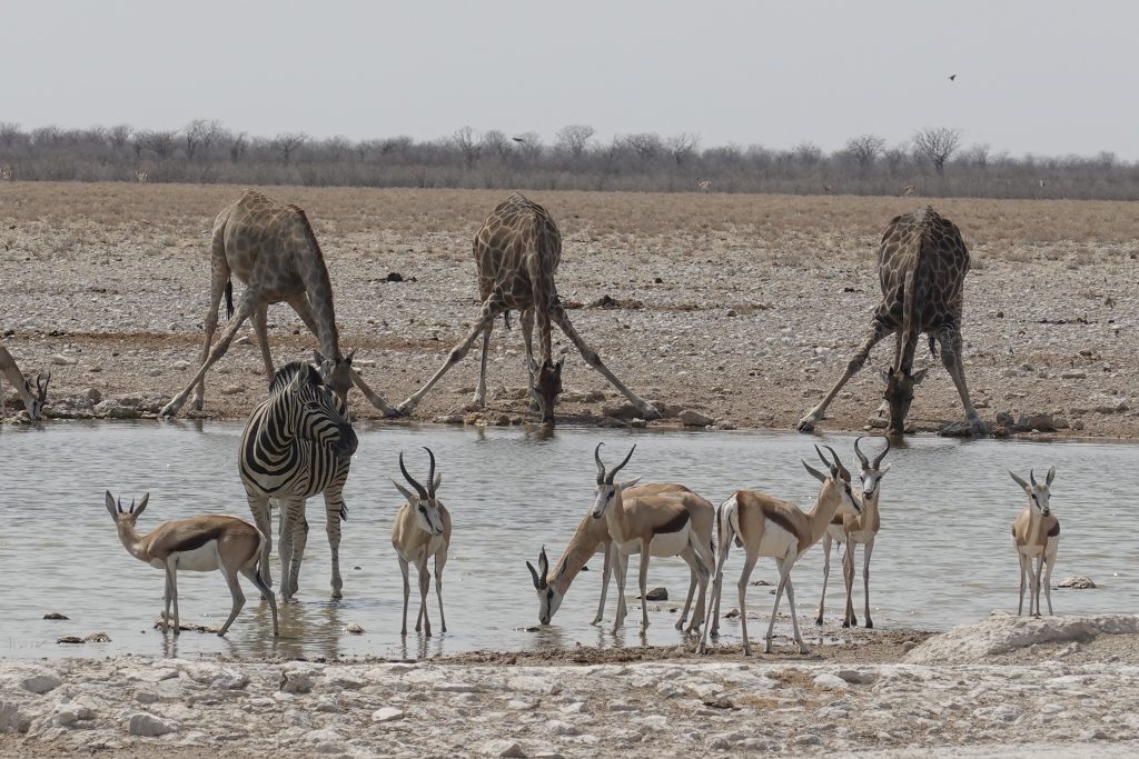
Gemsbok, springbok and ostrich occur inland on the gravel and sandveld, in country that looks incapable of supporting them.
The offshore islands within and near the park hold globally important seabird populations. Mercury Island alone holds around 16,000 African penguins on roughly three hectares, and Mercury and Ichaboe together hold close to 80 percent of the world population of the endangered bank cormorant.
Those islands are closed to the public and managed by the fisheries ministry, so viewing is from catamaran trips out of Lüderitz that pass Halifax Island.
Heaviside’s dolphins, endemic to the Benguela ecosystem, occur along this coast, with roughly 70 percent of the world population in Namibian waters.
Getting In
Access is the practical question and the answer is restrictive.
Registered operators offer day trips into Tsau Khaeb from Lüderitz. These must be booked several days in advance to allow time for permits to be obtained.
Self drive options are very limited. A weeklong 4×4 traverse from Lüderitz to Walvis Bay exists and is suitable only for those with considerable off road experience.
Kolmanskop and Agate Beach are the exceptions requiring no special permit, with Kolmanskop needing only the standard permit bought the day before at the Lüderitz tourist office.
Conditions are demanding. Expect heat, strong wind and cool misty conditions, sometimes on the same day.
Operators ask visitors to leave only footprints, which in country where a single vehicle track can persist for decades is a practical instruction rather than a slogan.
Practical Details
Base. Lüderitz, from which all operator trips depart. The town is 125 kilometres west of Aus on the B4, tarred, with sand blowing across the road on that stretch.
Booking. Several days ahead for permits. This cannot be arranged on the morning, unlike most Namibian activities.
Season. May to October is the cooler dry season and the best time. Summer is very hot, though birding is strongest then.
What to bring. Windproof layers, sun protection and sealed camera protection. Pomona records the highest wind velocities in Namibia.
Sperrgebiet Questions
What is the Sperrgebiet?
German for prohibited area, it is the diamond zone in southwestern Namibia sealed off by the colonial government in September 1908 after a railway worker named Zacharias Lewala found the first diamond near Grasplatz that April. Penalties for approaching within a hundred kilometres were severe. It is now Tsau ǁKhaeb National Park, and most of it remains closed to the public.
Can I visit it?
Parts of it, with an operator and a permit booked several days in advance. Registered operators run day trips from Lüderitz to sites including Bogenfels, Pomona and Saddle Hill. Kolmanskop and Agate Beach are exceptions needing no special permit. Self drive is very limited, with a weeklong 4×4 traverse from Lüderitz to Walvis Bay suitable only for experienced off road travellers.
Why does it matter ecologically?
Because closing it for a century excluded farming, grazing, settlement and roads, leaving the ecosystem undisturbed. It protects part of the Succulent Karoo, among the world’s top biodiversity hotspots with the greatest diversity of succulent flora on earth. Around 1,050 plant species occur there, close to a quarter of Namibia’s entire flora on under three percent of its land area.
What is Bogenfels?
A natural rock arch rising directly from the sea, around 55 metres high, and the headline sight of the park. It is reached on a long 4×4 day from Lüderitz with a permit and a registered operator. Other accessible sites include the abandoned mining town of Pomona, which records the highest wind velocities in Namibia, and the dunes around Saddle Hill.
When was it made a national park?
Sources differ, with some giving 2004 as the date of establishment and others 2008 as the year of proclamation and renaming. The likely explanation is that these mark different stages of a long process, with transfer of control from mining interests to the environment ministry taking longer again. The practical position for visitors is unchanged: most of the park remains closed.
What is the Bom Jesus?
A Portuguese vessel that sank in the early fifteen hundreds, found near Oranjemund inside the diamond area when mining operations exposed it. It is the oldest shipwreck found in sub-Saharan Africa and among the most important archaeological finds on the continent, with a cargo including copper ingots, ivory and a substantial quantity of gold coins. Recovery took close to two years.
How were the diamonds found?
On the surface rather than mined from pipes. They were carried down the Orange River from the interior over an enormous span and distributed north along the coast by currents and wind. Early accounts describe them glittering in valleys by moonlight and being picked up by hand. Around five million carats were recovered before the First World War interrupted production.
Booking Your Namibia Trip
The safari companies and tour operators listed on this website put trips like this together for a living and know which camps, guides and routes actually deliver. We are an independent guide to Namibia; we do not book or sell tours ourselves.
When you are ready, arrange your safari, tour or holiday with one of the recognised operators listed here. Tell them your dates and what matters most, and a real person, not a form, will handle the itinerary, park bookings and logistics for you.